Today I had a 7 mile workout planned, and 5 of it needed to be speed oriented. I wanted to tackle Yasso 800s one last time, and try to do them in their truest form, with 400 meter recovery jog in between each 800 meter. No standing or walking. Just jogging and giving it!
I planned to do 10×800, which would bring me to 5 miles. In between each 800 I would do a 400 meter recovery. I decided to start with a 400 m jog to get things going, and then do one in between each set, totaling 10×400. This would make today’s workout 7.5 miles. Sounds good to me! But I don’t have access to a real track…..
I have gone to the shale track downtown before. It works alright, except for the homeless man peeing behind the dumpster. I also tried the lake near my house. But I needed a change of scenery. I drove at 8:00 AM this morning over to North Lethbridge to Chinook Lake, an area I actually took my distance runners to quite a bit. I had them do some speed work and circuit training out here, so I figured I should give it a try myself. Nice thing was that at this time of day on a Monday the path was pretty empty. But, I needed an accurate reading of distance—I would figure this out by using my Nike+ SportWatch GPS.
I first walked the lake to see where 400 metres would take me. I started at a sign near the playground and looped to a lamppost around the first big curve. This was my 1/4 mile mark. I kept going and as I was getting back to my starting point, I knew I would overlap. I took a turn off a foot path into a cul de sac, around a corner, and finished off at a set of underground sprinklers. From the lamppost to this area was 800 metres, or 1/2 mile.
If you look at the map below, which I took from Google Maps, I outlined in color my two routes. The yellow star with a “1” is where I would begin. I followed the red path for 400 metres, but would not start my watch yet. Since I had already proven this to be 400 metres that was golden! Once I reached the lamppost, I revved it up, started the GPS timing and away I went for 800 m! You can see that route in the blue.

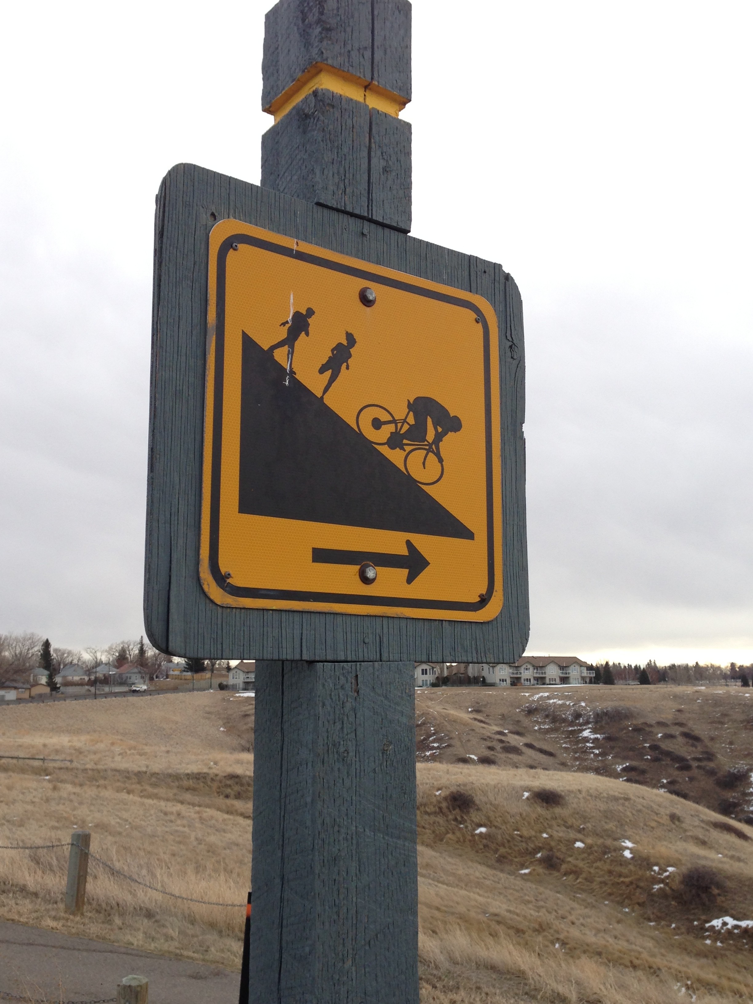
The obvious difference between doing these Yasso 800s here versus a standard outdoor track is terrain. While this was relatively flat, there are occasional divots in the ground, slight incline/declines, spots where one has to go off the paved path, and more importantly SHARP CURVES! When you do an 800 meter timed run on a traditional track you can hug the inside curve of lane 1, do 2 laps, and you know you ran 800 metres. Running Yasso 800s in Surburbia, in my opinion, adds some interesting elements.
So how did it go today? AWESOME! I stuck with my plan of doing the 400 m recovery jog in between. The only lag time between finishing my 800 and starting the 400 was when I stopped my watch, I would turn around and start power walking towards the starting sign, resetting my watch in the process so huge GPS was linked and set to go. This was between 5-10 seconds a time. My goal for these 800s was 3 minutes and 30 seconds, as I hope to run a 3 hour and 30 minute marathon in Edmonton on August 24th. Below are the list of my splits, in order that I ran them (to make things more cut and dry, I dropped off the nearest hundredth and did not round)
3:38, 3:25, 3:30, 3:34, 3:31, 3:30, 3:26, 3:30, 3:34, 3:23
I am very happy with my consistency, and I believe this was the most consistent I ever have been doing an 800 meter workout! I was a little slow the first time out, but I needed to get used to the terrain. I was a little fast the last time, but I just had my adrenaline going and knew I was done after that.
Since I am a math teacher, and I have time on my hands in the summer, I decided to figure out what my “mean” 800 meter time was during this workout. “Mean” is the math term you learned back in middle school where you take the sum of a certain amount of terms, and divide it by the total number of terms you had. Now, let me say this—-kids (and adults!) SUCK at working with fractions. Fractions may not be listed in my time right now, but 3:38 IS NOT, I REPEAR IS NOT 3.38 minutes. There are 60 seconds in one minute, and I used 38 seconds of it during the end of my first 800. 3 minutes and 38/60 seconds would then become 3.63 minutes, not 3.38! (3.63 is being rounded to the nearest hundredth). And while no one probably cares, below is my calculation for my MEAN time:
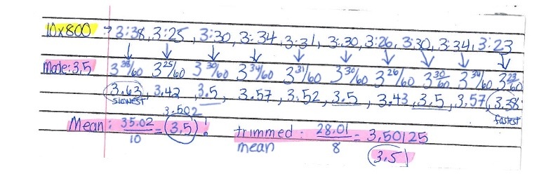
I was dead on! 3.5 minutes, or 3 minutes 30 seconds, was my mean time. Even if I trimmed the set of data, removing the highest and lowest value, now added up only 8 times, I still end up with 3.5! And, my mode, or most occurring value in my original set of data even is 3.5, occurring 3 times! Both are excellent measures of central tendency in determining my average time in this set of Yasso 800s.
I know it’s summer vacation, but I have to show you how you can in fact use math in your every day life. I would be a horrible math teacher if I didn’t. Now, my calculations better not be messed up!